About the Transit and Road Infrastructure Plan
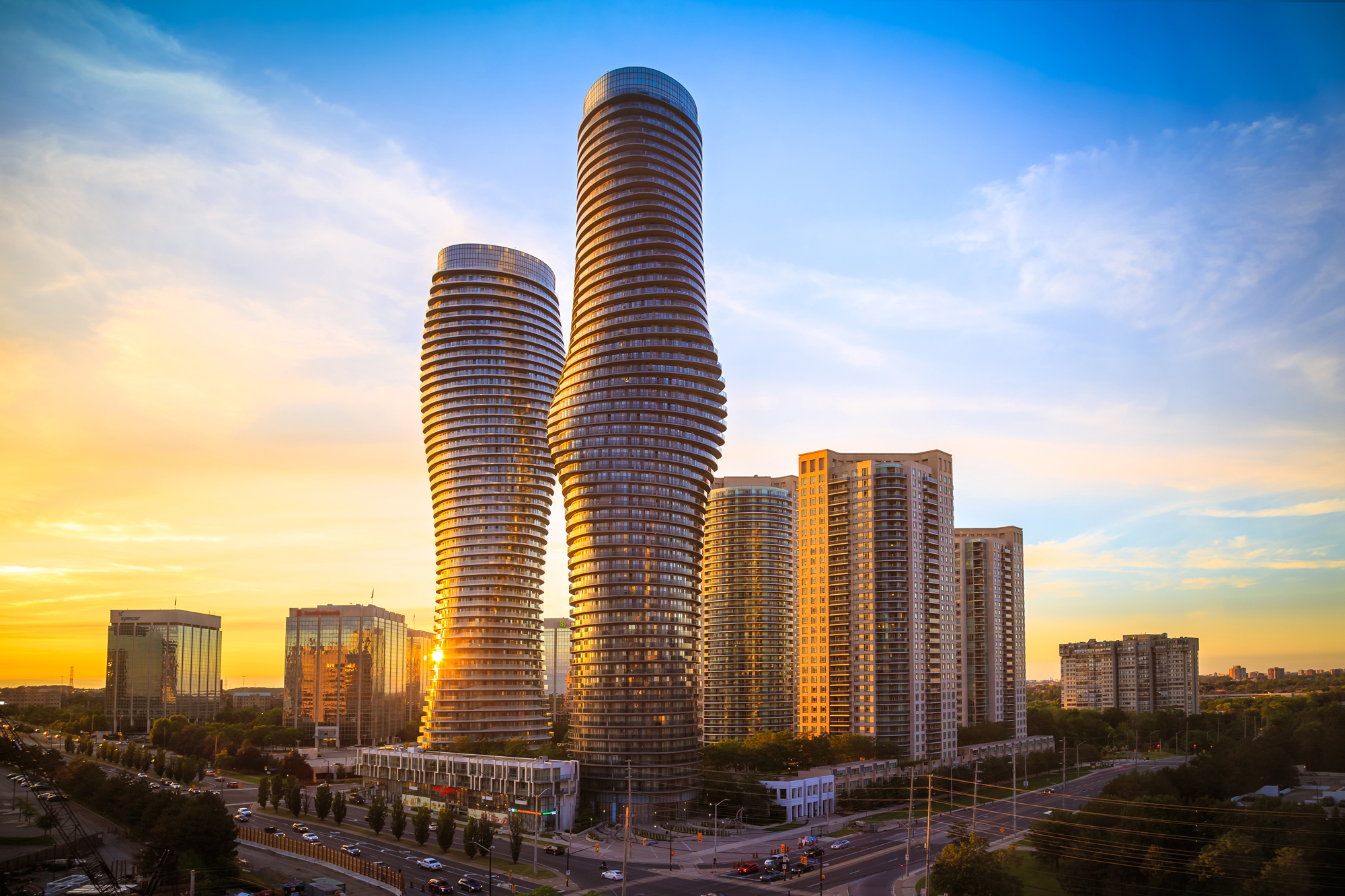
The Transportation Vision for Mississauga
Through the Mississauga Transportation Master Plan (TMP), a transportation vision statement for the city was identified.
In Mississauga, everyone and everything will have the freedom to move safely, easily, and efficiently to anywhere at any time.
The Transit and Road Infrastructure Plan (TRIP) is one of a series of mode-specific plans the City is undertaking to plan for an integrated transportation system to meet the needs of Mississauga’s residents, workers and visitors today and in the future.
TRIP Study Process
This study is being conducted in accordance with the requirements described in Approach #1 of the Municipal Class Environmental Assessment (EA) Process (Municipal Engineers Association June 2000, as amended in 2007, 2011 and 2015). The Master Plan process will satisfy Phase 1 and Phase 2 of the Municipal Class EA process - to identify the Problem and Opportunity, and to identify and evaluate Alternative Solutions to the Problem and Opportunity, respectively.
Direction and Opportunity
Alternative Solutions
Preferred Plan
Public Information Centre #1
Public Information Centre #2
Public Information Centre #3
Final Report
How TRIP aligns with other City Plans and Projects
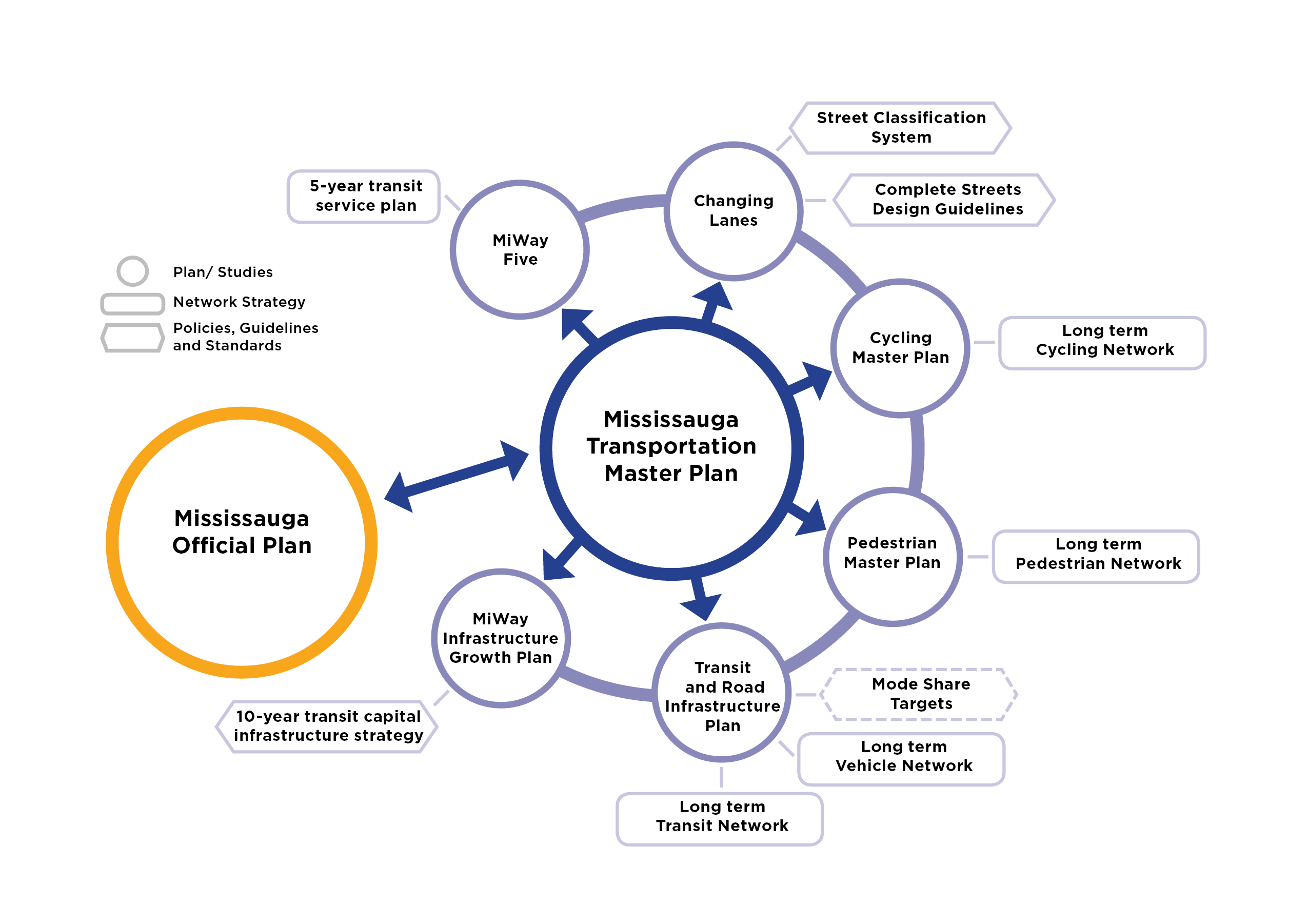
The Transit and Road Infrastructure Plan is one of several transportation planning studies that will guide the direction of the future transportation system.
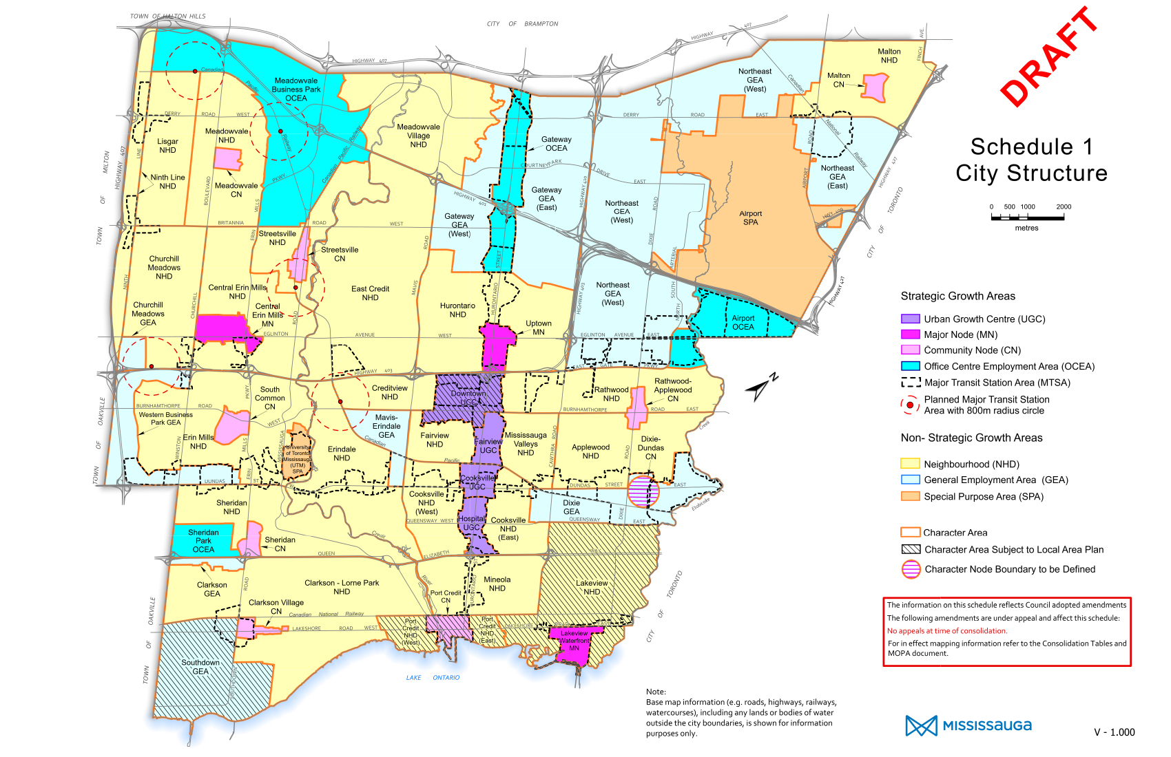
The City’s Official Plan provides policies that guide and direct the physical change of the city. We’re reviewing the existing Official Plan to ensure it reflects the changing needs, opportunities and aspirations of our city.
The Mississauga Transportation Master Plan provides overarching guidance on the future of transportation in Mississauga and specifically calls for mode specific infrastructure plans such as this TRIP study.
The City of Mississauga has adopted Vision Zero, an approach to transportation that sets a vision for zero fatal or injury-causing collisions.
The City’s Climate Change Action Plan aims to reduce greenhouse gas emissions by 80% by 2050. As transportation is one of the major contributors to greenhouse gas emissions, the City supports efforts to shift travellers to lower-emission modes, such as transit, cycling and walking.
Engagement Summary
Public Engagement
Over the course of the study, we have sought input from the community through various methods:
- Study website at: yoursay.mississauga.ca/transit-and-road-infrastructure-plan
- Public Open House sessions
- Virtual: November 30 to December 20, 2020
- Virtual: June 6 to 27, 2022
- Virtual: May 23 to June 12, 2023
- In-person: May 23, 20023, 6:00 to 8:00 p.m., Mississauga City Hall
- Outreach to community stakeholders and neighbourhood associations in February 2021.
- Meetings with Technical Agencies in February 2021, April 2022, and April 2023.
What We’ve Heard
Road widenings should be discouraged unless they are for cycling infrastructure or transit priority lanes.
A strong and efficient public transit system is integral to support business and its workers.
Bus connections and bus frequency needs to be improved to see a shift from travel by cars to travel by transit.
A greater emphasis should be placed on moving the highest number of people, not cars, as efficiently and safely as possible
The road network and transit priority network must work together to achieve the objectives of the plan.
Lane reduction and road diets need to be a priority. Six-lane roads encourage speeding and reckless driving.
More emphasis on connectivity within the network is needed.
The road network should also reflect the needs of goods movement in the broader region.
Needs and Opportunities
Key transportation issue
The majority of Mississauga residents use an automobile as their primary mode of transportation.
Opportunity/study direction
Support the City’s Climate Change Action Plan by making sustainable, lower-emission modes (low-emission MiWay transit vehicles, walking and cycling) more attractive for more travellers.
Key transportation issue
The road network will approach vehicular capacity in many areas of the city if current travel trends continue, impacting how well people and goods move around the city.
Opportunity/study direction
Move people and goods more reliably by addressing gaps in the network, prioritizing transit between key destinations, and developing strategies for goods movement.
Key transportation issue
While more people are making trips by transit, travel time by transit can take two to three times as long versus the automobile
Opportunity/study direction
Implement more Transit Priority Corridors to provide fast, reliable, and efficient transit to more people.
Key transportation issue
Transit and road improvements are needed to support equity-seeking neighbourhoods and new transit-oriented communities around Major Transit Station Areas.
Opportunity/study direction
Expand infrastructure and services where needed to ensure equitable access for all users – with a focus on equity-seeking neighbourhoods and transit-oriented communities.
Key transportation issue
Addressing road safety for all users will make roads safer and more comfortable for pedestrians and cyclists – allowing these modes to be the mode of choice for short trips.
Opportunity/study direction
Support the City’s Vision Zero initiative by focusing on protecting vulnerable road users when planning and implementing road and transit infrastructure.
Key transportation issue
Connections outside of Mississauga are also important to the transportation system for Mississauga’s residents and workers.
Opportunity/study direction
Provide a connected, integrated transportation system within the city and improved access to hubs outside the city where people are travelling to.
Alternative Solutions
Seven alternative solutions were identified to address the needs and opportunities.
Transit-focused Solutions
1. Higher-order transit corridors with bus-only lanes.
Source: Dundas BRT TPAP, Metrolinx/Mississauga
2.Transit priority measures such as queue jump lanes for buses at intersections.
Road-focused Solutions
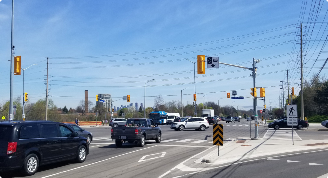
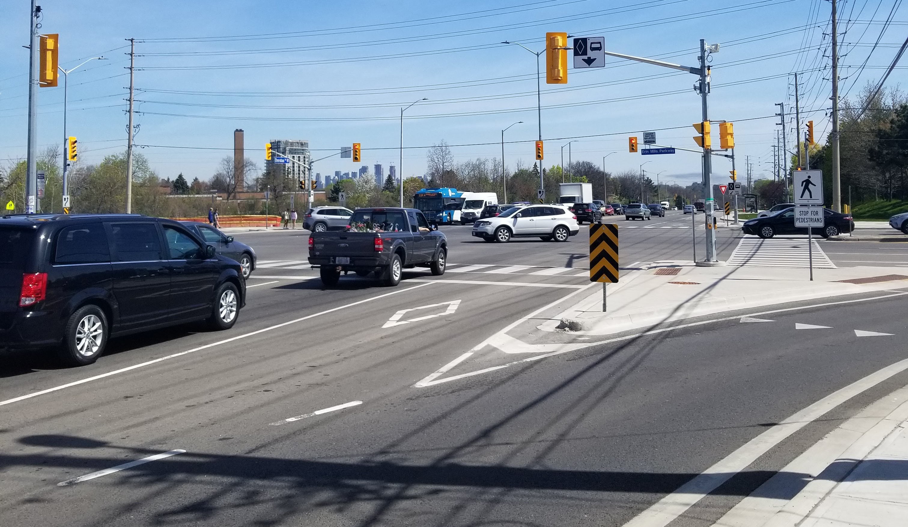
3. High Occupancy Vehicle (HOV) lanes shared by carpools and buses.
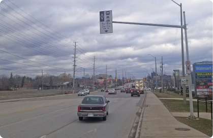
4.New roads or wider roads with additional travel lanes.
5.Road diets where part of the existing roadway width is reallocated for other uses such as bicycle lanes, sidewalks, patios or parklets.
Network Solutions
6. Traffic system management to monitor and improve traffic flow, including transit signal priority.
7. Travel demand management programming to promote commuting by transit, carpools, etc.
Evaluation Criteria
The alternative solutions were evaluated against the following criteria:
Vision: aligns with TMP vision and study directions:
- Make sustainable modes more attractive
- Address gaps, prioritize transit and goods movement
- Implement more Transit Priority Corridors
- Improve transportation equity
- Support Vision Zero (Road Safety)
- Provide connected system and access to hubs
Mobility Impacts: how well the network performs, available network capacity, reductions in delays
Community Impacts: supports community health and active lifestyles, provides transportation equity
Economic Impacts: supports businesses, provides reliable goods movement
Environmental Impacts: minimizes impacts to the natural environment (e.g., woodlands, rivers), minimizes impacts to cultural heritage features (e.g., historic buildings, cemeteries).
Financial Impact: minimizes capital costs, minimizes on-going operations and maintenance costs
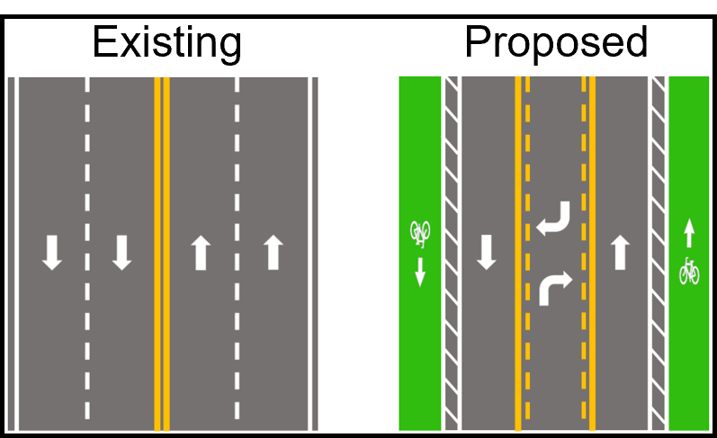
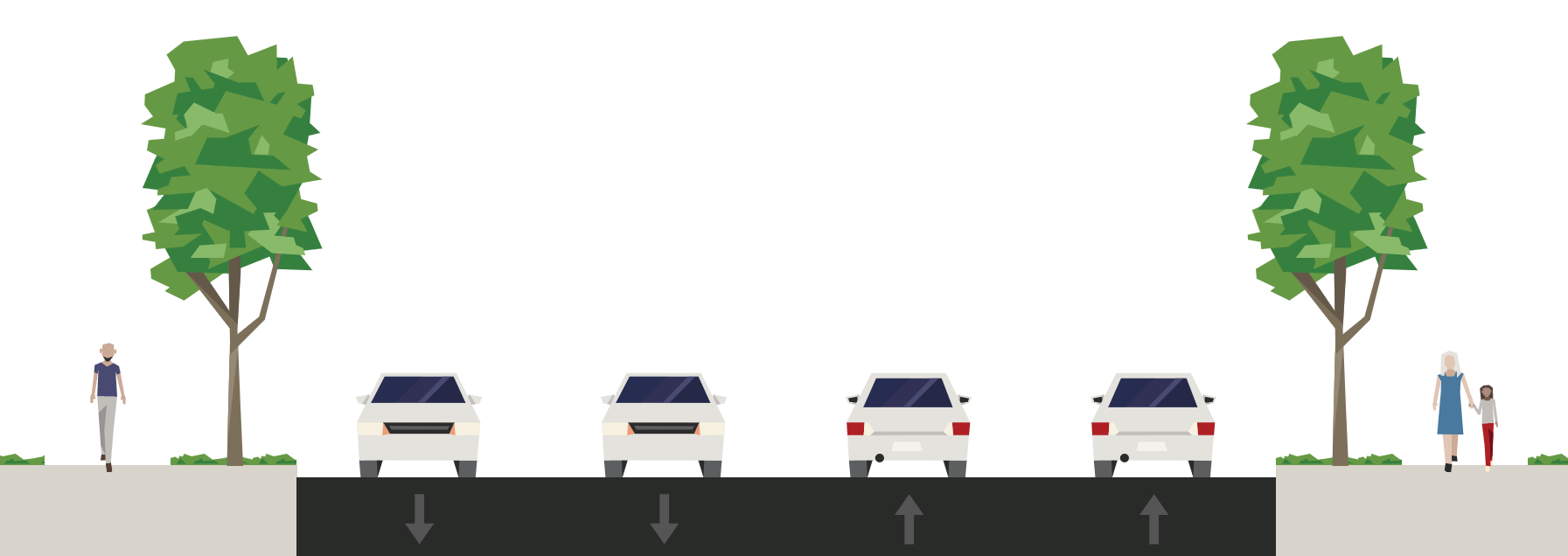
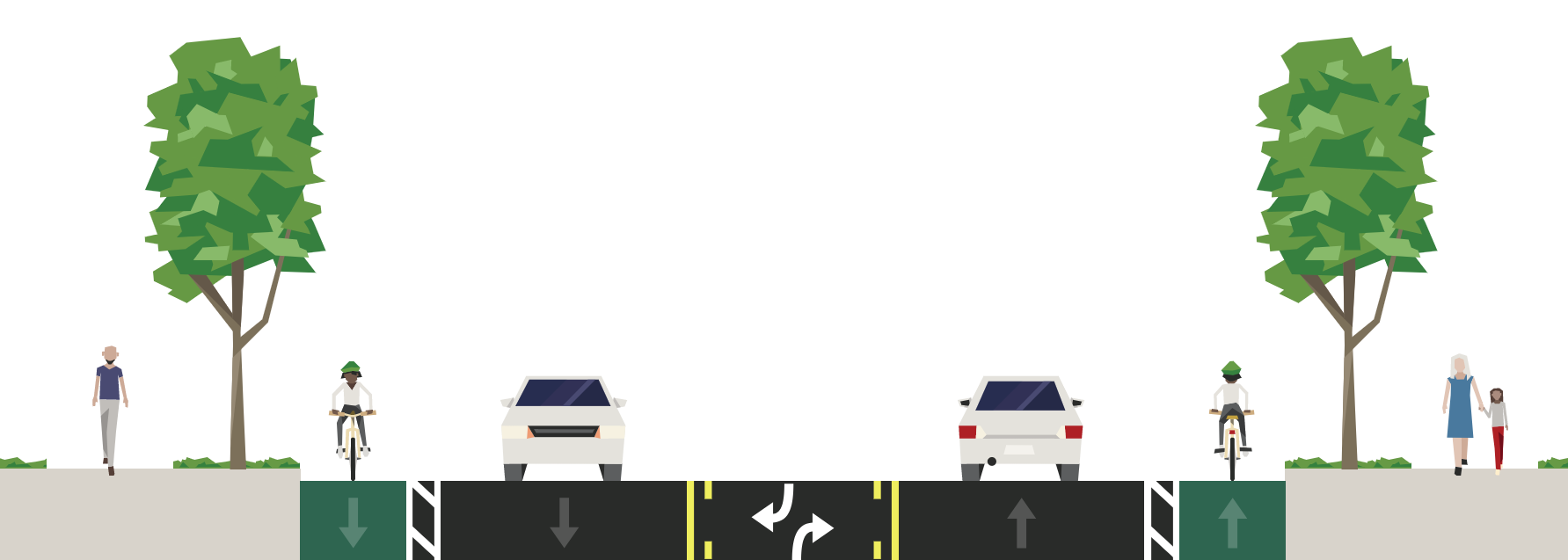
Road Diets
What are Road Diets?
A road diet re-purposes roadway space for other non-vehicle uses and users. It prioritizes the public realm, benefiting pedestrians and cyclists.
Improved cycling facilities
Improved pedestrian realm
Improved road safety
A common road diet example is the conversion of a 4-lane road to a 3-lane road as shown below.
Before Road Diet
After Road Diet
Made with Streetmix
Potential Road Diet Locations
Mississauga’s road network was reviewed to identify locations where a road diet could be considered. Ideal candidate corridors provide access to adjacent lands, served community uses, and have high potential for pedestrian and cyclist activity.
Potential locations for further study include:
- Aquitane Avenue
- Argentia Road
- Battleford Road
- Central Parkway
- Erin Centre Boulevard
- Erindale Station Road
- Glen Erin Drive
- Rathburn Road
- Ridgeway Drive
- The Collegeway
- Thomas Street
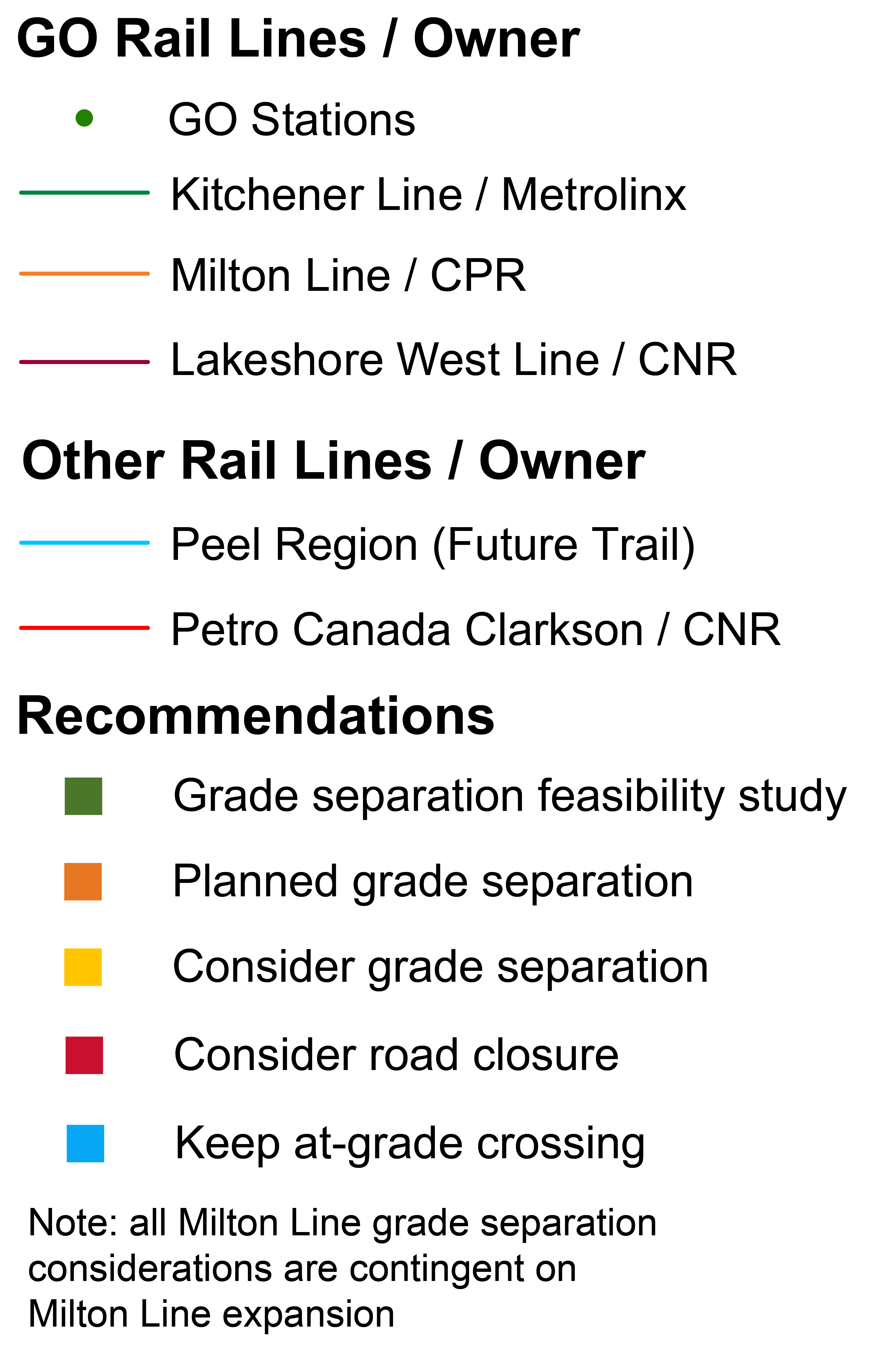
Rail Grade Separation
As Mississauga continues to grow, increased auto traffic and train volumes will raise safety concerns at at-grade locations.
All existing at-grade crossing locations in Mississauga have been assessed to identify opportunities for potential rail grade separation. Factors considered include forecasted vehicular traffic, future trains, and surrounding land use.
At-grade rail crossing
Grade separated rail crossing
Recommendations for At-Grade Rail Crossings
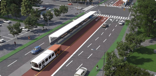
Transit Priority
Transit Priority Types
Three transit priority categories were defined for the future transit network. Examples of each type of transit priority are shown below.
| Category | Description | Example Improvement |
|---|---|---|
| 1 | Dedicated Lanes | Dedicated transit lane |
| 2 | Enhanced Corridor Improvements | HOV / transit lanes |
| 3 | Intersection Improvements | Queue jump lanes |
1. Dedicated Lane
Example: Dundas BRT
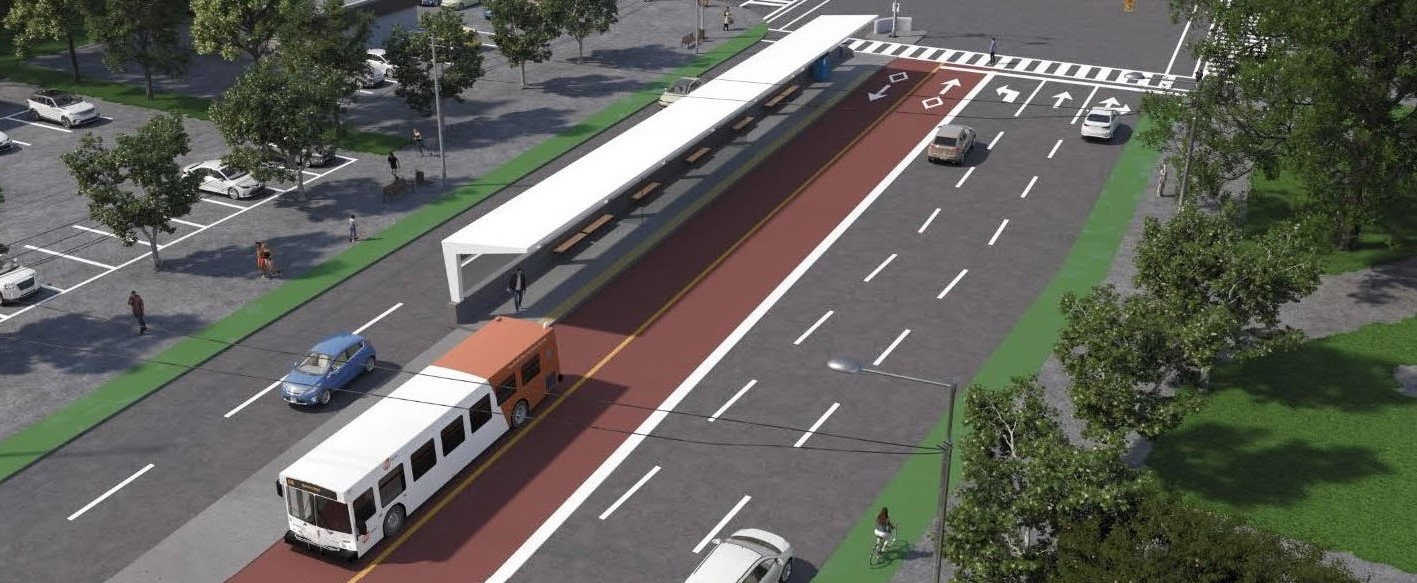
Source: Dundas BRT TPAP, Metrolinx/Mississauga
Example: RapidTO Eglinton East
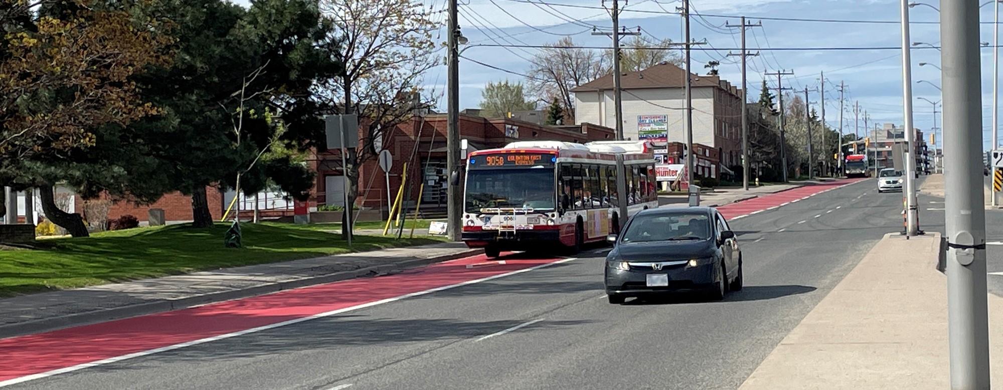
2. HOV / Transit Lane
Example: Dundas Street East
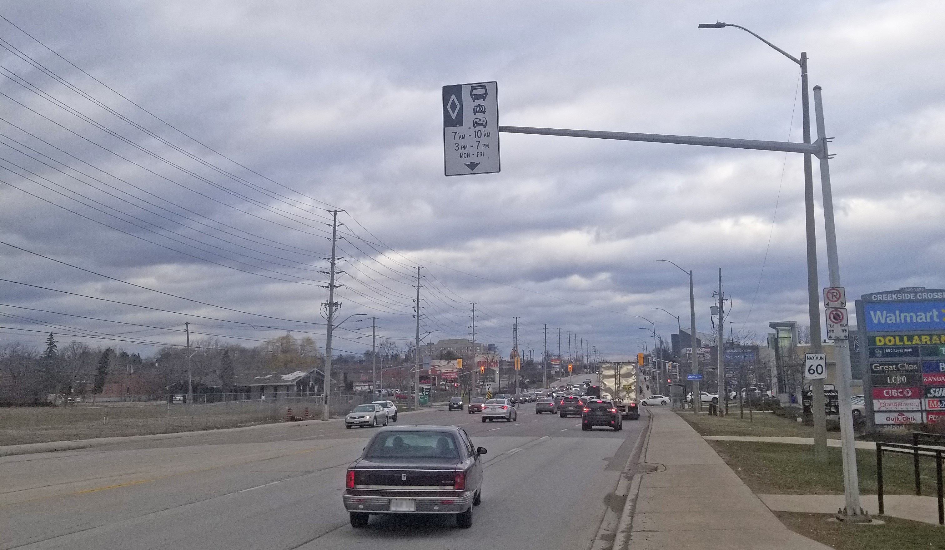
3. Queue Jump Lane.
Example: Dundas Street West
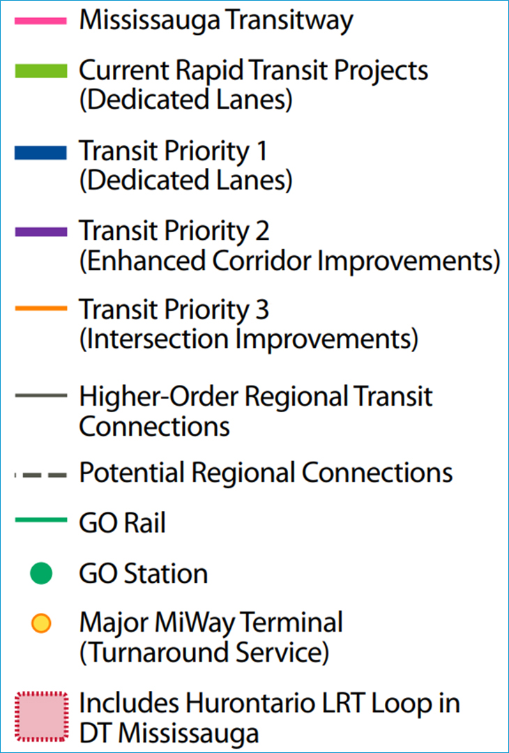
Recommended Network – Transit
The recommended transit network includes:
- 64 km of dedicated bus lanes
- 37 km of enhanced transit corridors
- 120% increase in ridership by 2041 (from 2016)
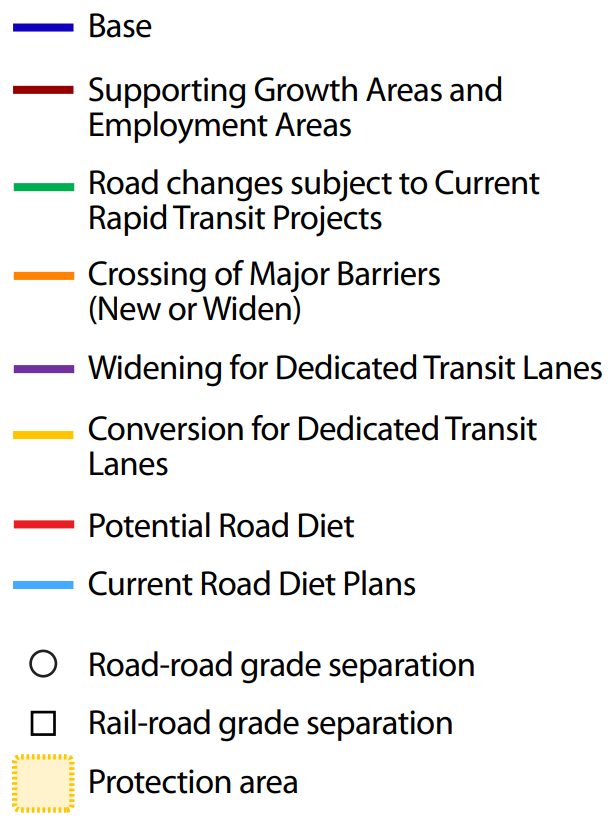
Recommended Network – Road
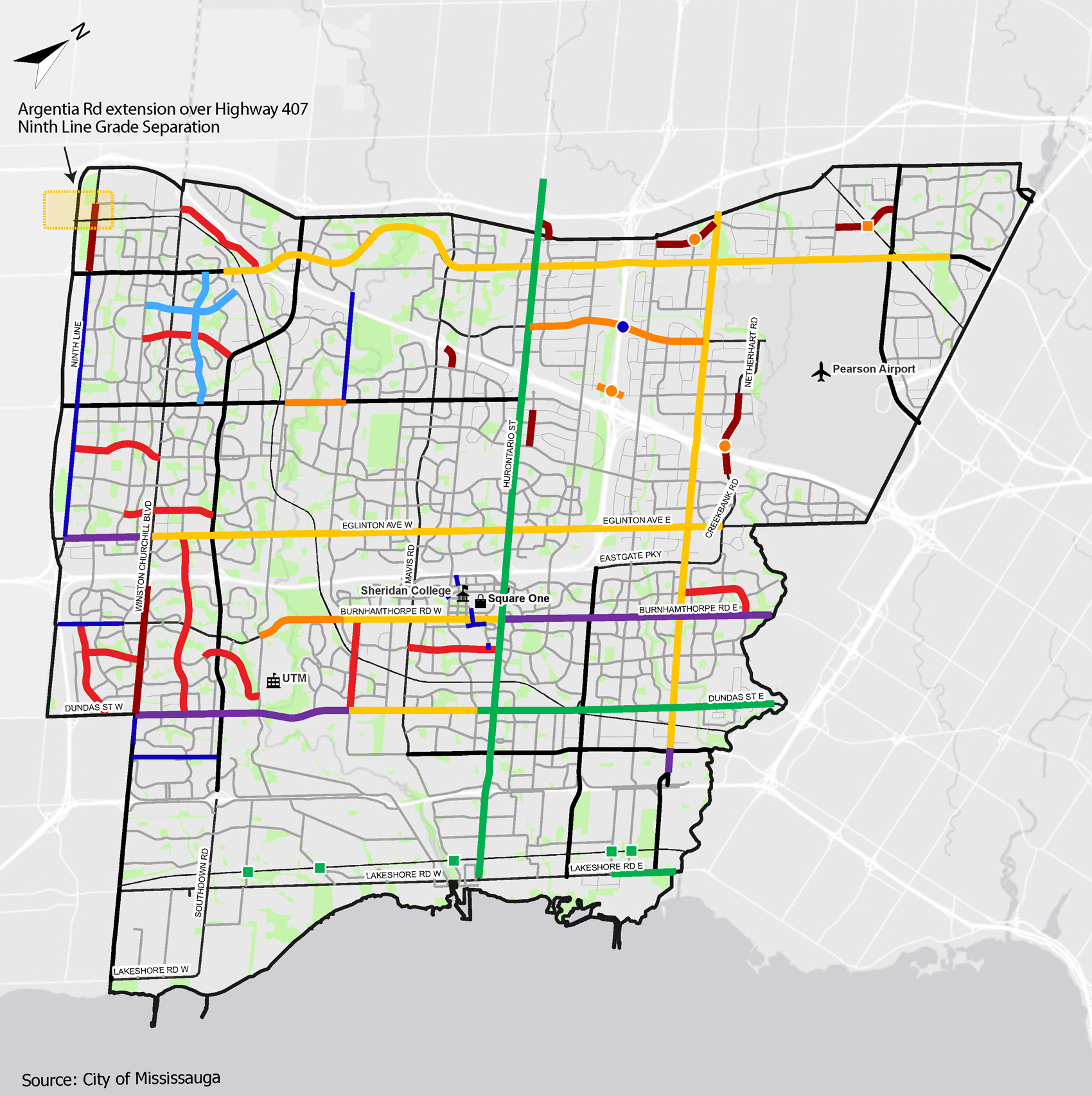
The recommended transit network includes:
- 30 km of new or expanded roadways
- Four new crossings of major barriers
- Road expansions to accommodate recommended transit network
- Up to 31 km of road diets
Achieving the Plan
Aligning Transportation and Land Use
Mississauga’s past growth has helped shape the transportation system that exists today. The new growth that is planned for Mississauga in the upcoming decades provides an opportunity for the City to better align land use and transportation planning through the following actions:
- Supporting policies that advance transit-oriented development.
- Encouraging infill development and compact land uses in new growth areas.
- Conducting Secondary Plan, Transportation Master Plan, or high-level MTSA studies to guide the implementation of well-connected transportation systems to support growth areas.
- Ensuring a complete streets approach in the design of new streets and retrofitting existing streets.
- Exploring opportunities to integrate emerging mobility options in new development and in existing streets.
Achieving the Plan (continued)
Promoting Sustainable Modes
Intensification and redevelopment provides the City with opportunities to develop communities that are well supported by transit, walking, and cycling through the following actions:
- Addressing network and crossing gaps in the pedestrian network as identified in the Mississauga Pedestrian Master Plan, prioritizing connections to transit.
- Constructing new cycling facilities and upgrading existing cycling facilities as identified in the Mississauga Cycling Master Plan.
- Implementing transit priority measures to improve transit operations along corridors and at intersections as presented in the Recommended Transit Network.
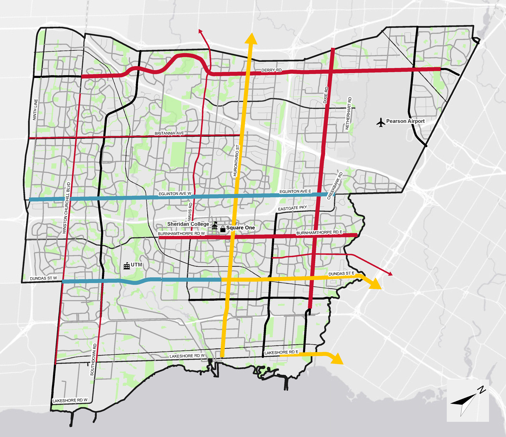
Pedestrian Master Plan
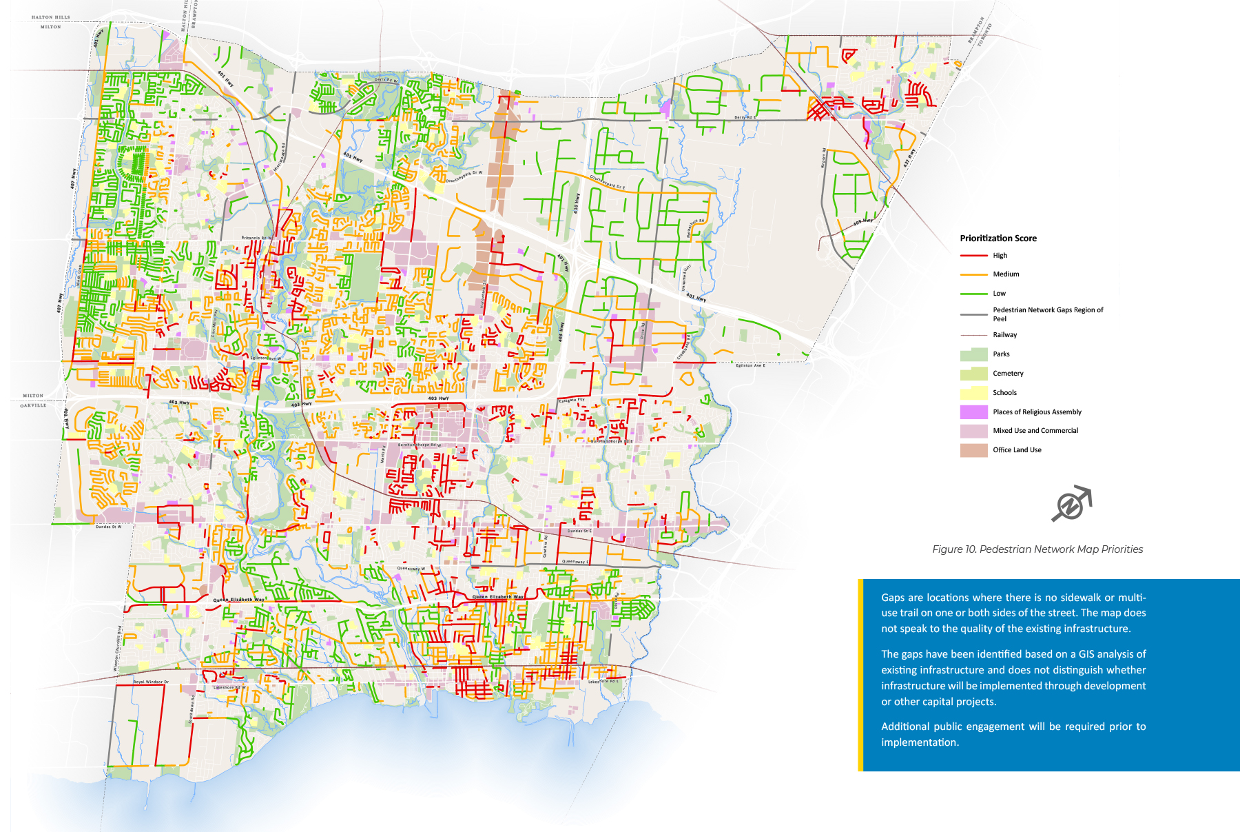
Click map to enlarge
Cycling Master Plan
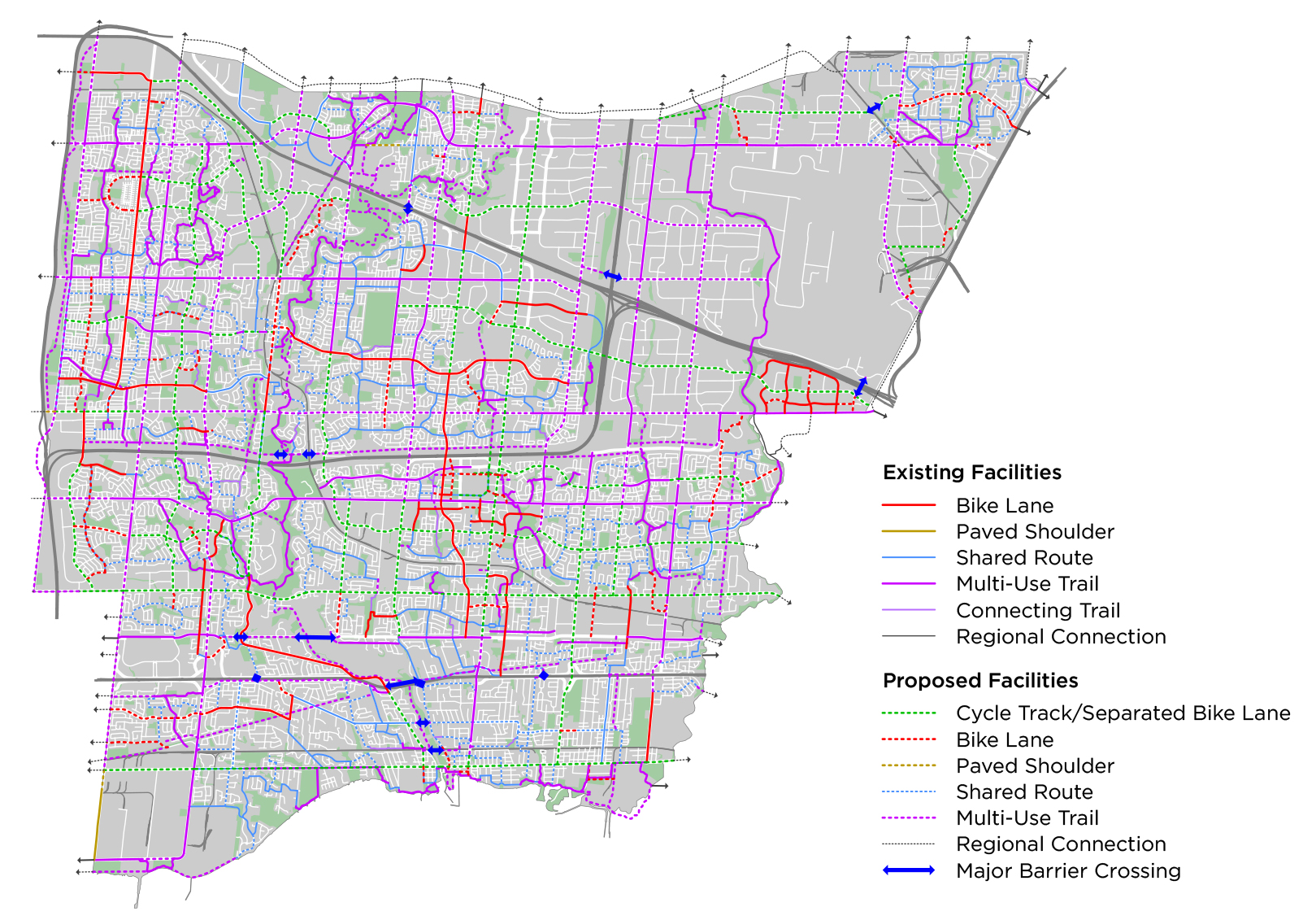
Click map to enlarge
Achieving the Plan (continued)
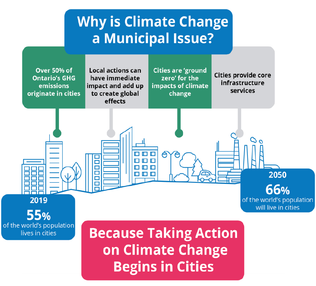
Mitigating and Adapting to Climate Change
The City of Mississauga has already begun to feel the impacts of climate change, including increased seasonal flooding, extreme rainfall, ice storms, and record-breaking summer temperatures. Transportation-related actions to mitigate and adapt to climate change include:
- Supporting sustainable transportation modes such as walking, cycling and transit by integrating the future road and transit networks with the City’s cycling and pedestrian networks.
- Investing in transit infrastructure and frequent transit service to provide improved access to high-quality transit service.
- Adopting zero emission vehicles for transit and city fleet and develop a strategy to accelerate the adoption of zero emission vehicles in the community.
- Working with industry and businesses to adopt lower-emission vehicles in the goods movement sector.
- Applying Low Impact Development (LID) practices and green infrastructure to manage stormwater run-off.
- Designing for climate impacts such as heat waves, heavy rainfalls, wind storms, and extreme cold when constructing or replacing transportation infrastructure.
Source: Mississauga Climate Change Action Plan
Example of Low Impact Development (LID)
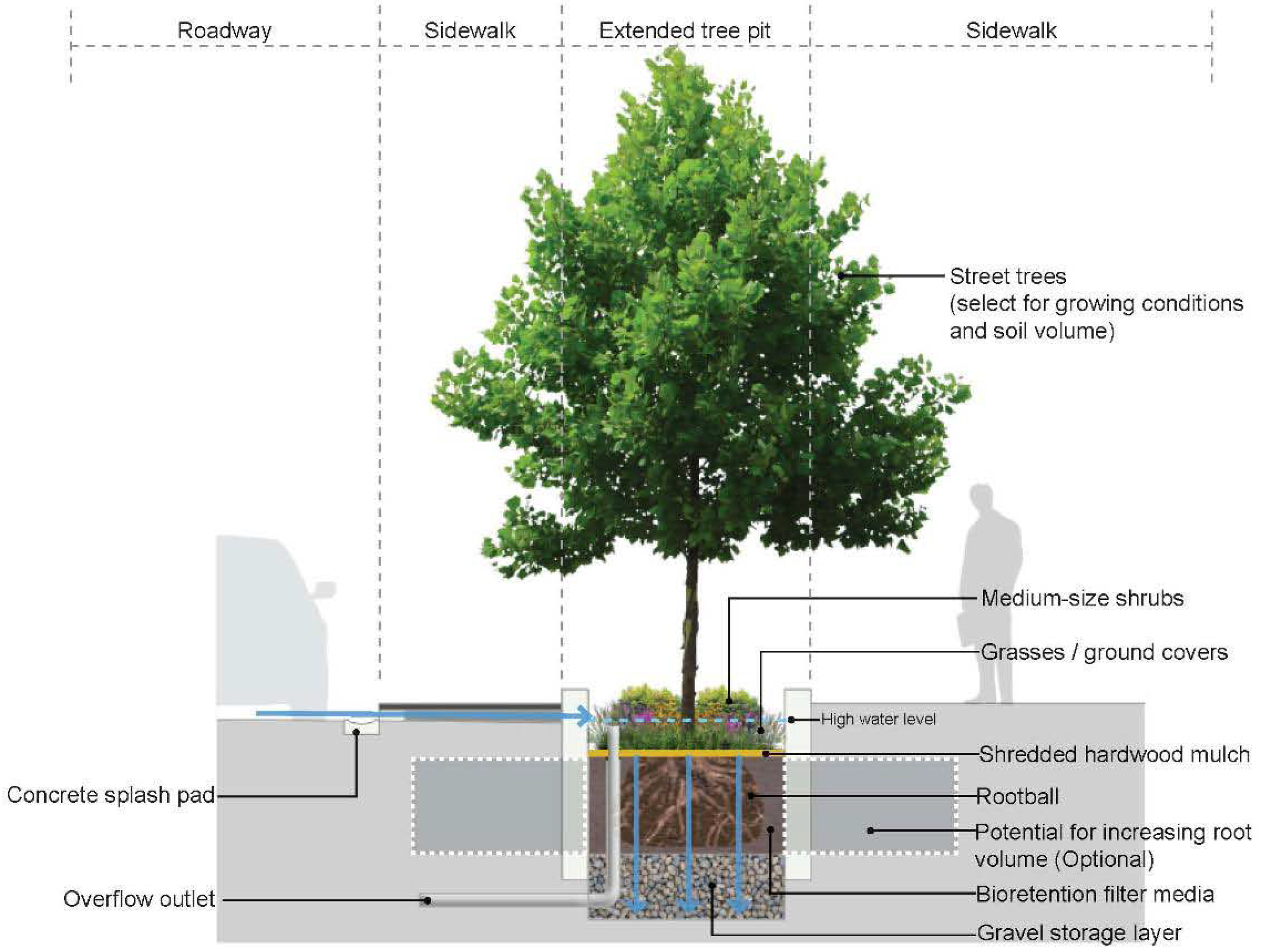
Source: Low Impact Development Stormwater Management Planning And Design Guide, Credit Valley Conservation / Toronto and Region Conservation
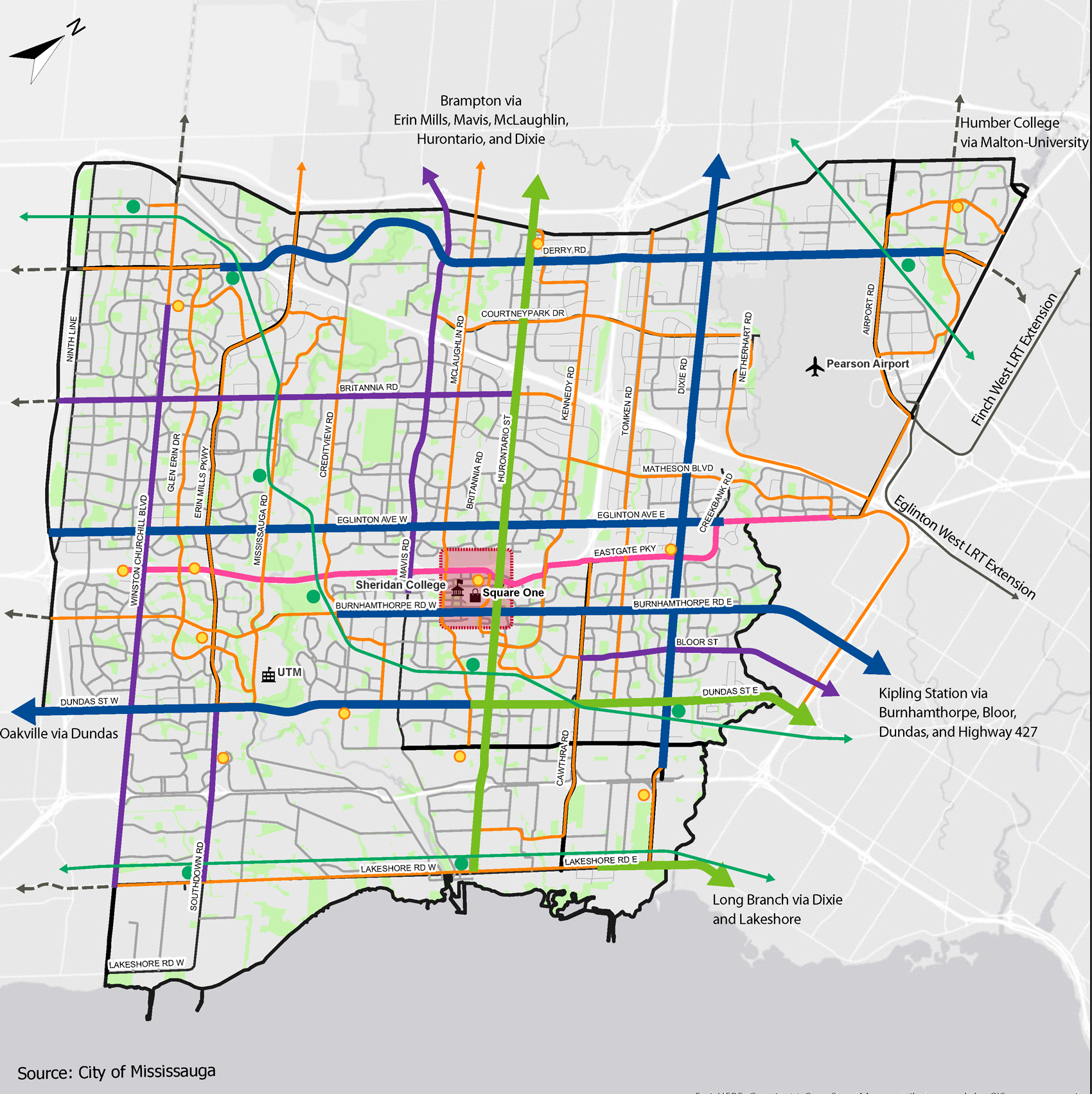
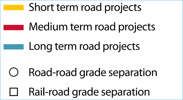
Recommended Network Phasing
The proposed phasing of the TRIP projects are shown below.
Transit Network
Click map to enlarge

Road Network
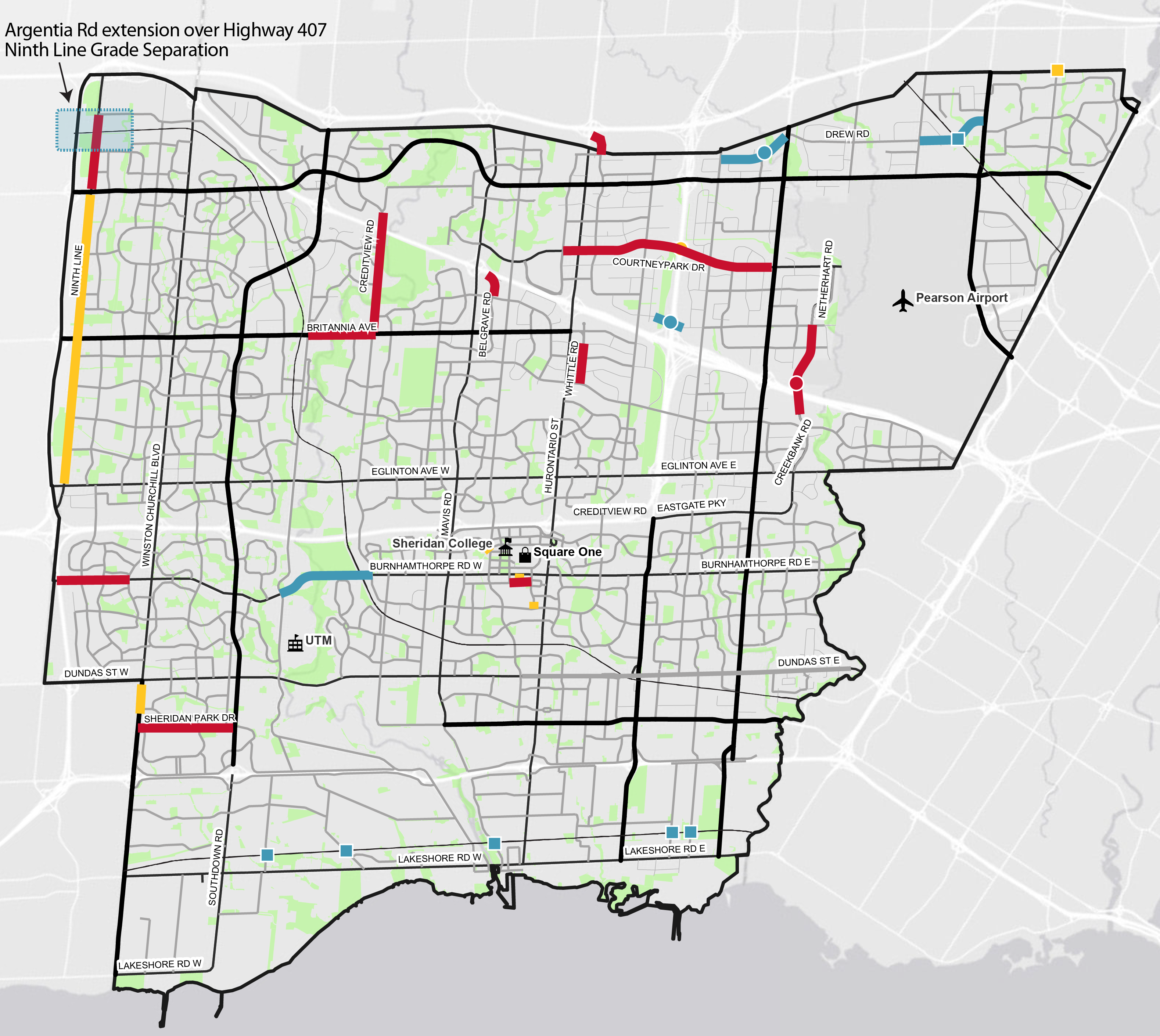
Click map to enlarge
Next Steps
- Refine the recommendations based on public feedback.
- Present the draft TRIP report to Council.
- Finalize the TRIP study.
- Incorporate the recommended TRIP networks into the Mississauga Official Plan.
Phase 1: Identify Problem and Opportunity
Define a study direction and assess existing transportation conditions. Gather feedback on the Problem and Opportunity Statement.
Phase 2: Evaluate Alternative Solutions to the Problem and Opportunity
Undertake transportation assessment of proposed alternative solutions. Gather feedback on the evaluation of the alternative solutions.
Phase 3: Preferred Plan
Finalize the preferred plan and develop priorities and phasing plan for the recommended transportation infrastructure improvements.
We want to hear from you
For more information, visit us at:
![]() yoursay.mississauga.ca/transit-and-road-infrastructure-plan
yoursay.mississauga.ca/transit-and-road-infrastructure-plan
You can reach the project team by sending an email to:
Follow us on social media
![]() facebook.com/citymississauga
facebook.com/citymississauga
![]() twitter.com/citymississauga
twitter.com/citymississauga
![]() linkedin.com/company/city-of-mississauga
linkedin.com/company/city-of-mississauga